Storm Alert – Hurricane Idalia – Code Red (8/29 PM)
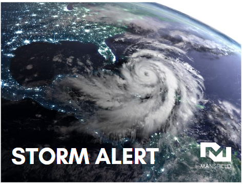
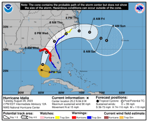
Hurricane Idalia continues to trek northward, with officials now saying the storm will make landfall in the “Big Bend” region of Florida, where central Florida meets the panhandle. The storm would be one of the first major hurricanes on record to strike this region. For that reason, weather experts are expecting record-breaking storm surge for those areas, though other storms have brought larger storm surge in other areas. To the south, Tampa Bay is expecting 4-7 feet of storm surge; the previous record in this region was 4 feet.
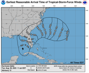
Landfall is expected around 8 a.m. on Wednesday morning, though dangerous tropical-storm-force winds will hit portions of Florida as early as this evening. Idalia will linger for a brief period, spending the next 12 hours over northern Florida and southern Georgia before continuing past the coastal South Carolina region into the Atlantic. From there, some models show Idalia spinning back towards the coast, though it’s unknown whether the storm will hold together or disband before re-approaching land.
States are preparing for the approaching storm. Florida declared a state of emergency ahead of the storm, waived regulations such as licensing and hours-of-service requirements, and ordered evacuations in over 20 counties. Governor Brian Kemp has declared a state of emergency for the entire state of Georgia. Preparations are underway to protect residents and ensure a speedy response to any damage incurred.


In light of the storm’s current path, Mansfield is moving to Code Red through all of Georgia and Florida, requesting 72-hour notice for new deliveries. Coastal South Carolina remains on Code Orange. Mansfield is still at Level 4 alert, with the highest level of operational preparedness underway to ensure deliveries can occur in a timely and safe manner.
This article is part of Alerts
MARKET CONDITION REPORT - DISCLAIMER
The information contained herein is derived from sources believed to be reliable; however, this information is not guaranteed as to its accuracy or completeness. Furthermore, no responsibility is assumed for use of this material and no express or implied warranties or guarantees are made. This material and any view or comment expressed herein are provided for informational purposes only and should not be construed in any way as an inducement or recommendation to buy or sell products, commodity futures or options contracts.


