Storm Alert – September 16, 2024 – Tropical Storm Helene
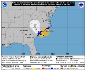
Mansfield has been closely monitoring another tropical disturbance, Potential Tropical Cyclone Eight, which is located 85 miles south of Cape Fear, North Carolina. In anticipation of Helene intensifying, Mansfield proactively topped off our customer tanks over the weekend.
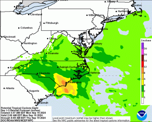
Currently named Potential Tropical Cyclone Eight, the disturbance is expected to develop into Tropical or Subtropical Storm Helene before making landfall on the South Carolina coast later today. The storm could bring four to eight inches of rainfall, with isolated areas seeing up to 10 inches. Tropical storm warnings have been issued from Edisto Beach, South Carolina, to Ocracoke Inlet, North Carolina, with winds of 39 mph or higher expected. Coastal areas, including Wilmington, North Carolina, are already experiencing gusts over 40 to 50 mph and flooding. The National Hurricane Center is giving Helene a 50% chance of developing into a depression or storm.


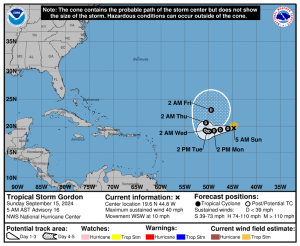
Tropical Storm Gordon has continued to weaken and is far from land, and it’s possible that it could degenerate into a remnant soon. If Gordon survives or picks back up speed, it is not expected to reach the US.

Mansfield will continue monitoring these storms and will provide updates as more information becomes available.
This article is part of Alerts
Tagged:
MARKET CONDITION REPORT - DISCLAIMER
The information contained herein is derived from sources believed to be reliable; however, this information is not guaranteed as to its accuracy or completeness. Furthermore, no responsibility is assumed for use of this material and no express or implied warranties or guarantees are made. This material and any view or comment expressed herein are provided for informational purposes only and should not be construed in any way as an inducement or recommendation to buy or sell products, commodity futures or options contracts.


