EIA’s Energy Infrastructure with Real-Time Storm Information
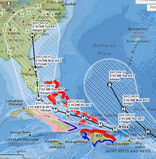
Did you know the EIA has a live map with storm updates overlaying the U.S.’s energy infrastructure? The site shows how extreme weather events line up with energy systems like power lines, pipelines, refineries, oil rigs, and more.
As the map below shows, Irma will travel over several Caribbean islands before skirting over Florida. Fortunately for areas outside of Florida, none of the oil infrastructure in Florida is critically linked to outside areas; that is, you won’t see the cascade failure experienced after Harvey. Still, the storm will cut of fueling in Florida as ports close, creating a shortage in the state until the storm passes. We’ll share more information about Florida’s fuel markets in today’s Storm Alert update.
Click Here to see the interactive map.
This article is part of Daily Market News & Insights
Tagged:
MARKET CONDITION REPORT - DISCLAIMER
The information contained herein is derived from sources believed to be reliable; however, this information is not guaranteed as to its accuracy or completeness. Furthermore, no responsibility is assumed for use of this material and no express or implied warranties or guarantees are made. This material and any view or comment expressed herein are provided for informational purposes only and should not be construed in any way as an inducement or recommendation to buy or sell products, commodity futures or options contracts.


