
Mansfield Storm Alert: Hurricane Matthew – Still RED ALERT
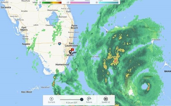
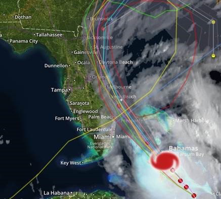
Gainesville, GA – October 6, 2016 – Analysis by Evan Smiles – Once again, Hurricane Matthew has shown its unpredictability, with the entire state of FL now at risk. Matthew became better organized as we went through the overnight hours, knocking on the door of category 4 status. The east coast of Florida is already feeling some effects from the outer bands of this storm. This morning, squalls of rain have been pounding the coast from the Florida Keys up through Jacksonville. The winds remain on the lighter side for right now, with no area in South Florida receiving consistent tropical storm force winds yet. Today is the day, however, that we (and all residents in Florida) have been preparing for over the last week. Conditions will deteriorate as we continue through the day, with a landfall expected anywhere from Palm Beach County northward to Flagler County. Many Port Everglades terminals have already shut down and are expecting to reopen when conditions are safe to do so. Supply is keeping an eye on all the other terminals in South/East Florida, from Tampa to Orlando to Cape Canaveral and Jacksonville.
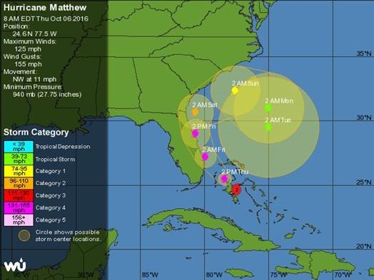 This is the timeline of winds for the east coast of Florida:
Miami-Dade and Broward counties: Tropical storm force winds are expected to begin around late morning and continue through the early morning hours of Friday. Gusts of hurricane force are possible.
Palm Beach/Martin/St Lucie counties: Tropical storm force winds are expected to begin in the early afternoon. Hurricane force winds are expected to begin in the late evening hours, with the worst happening after dusk. Gusts of over 110 mph are expected.
 Indian River/Brevard/Volusia counties: Tropical storm force winds are expected to begin in the evening hours. Hurricane force winds are expected to begin in the overnight hours, with the worst happening after midnight. Gusts of over 110 mph are expected.
Flagler/St. Johns/Duval/Nassau counties: Tropical storm force winds are expected to begin in the morning hours on Friday. Hurricane force winds are expected to begin Friday around noon. Gusts of over 90 mph are expected.
*Many other counties in Florida will be experiencing tropical storm and hurricane force winds; the ones listed above are only the coastal counties.*
 These wind predictions are subject to change as the exact path of Matthew can still vary. We are certain, however, that Florida will be impacted by hurricane force winds and hundreds of thousands (if not over a million) people will be without power after it’s all said and done. Storm Alert: Hurricane Matthew – Still RED ALERT – Thursday October 6thFor this reason, we are keeping Florida on RED alert. We will continue to keep Georgia, South Carolina and North Carolina on ORANGE alert.


